So what is the Whistlestop Walk?
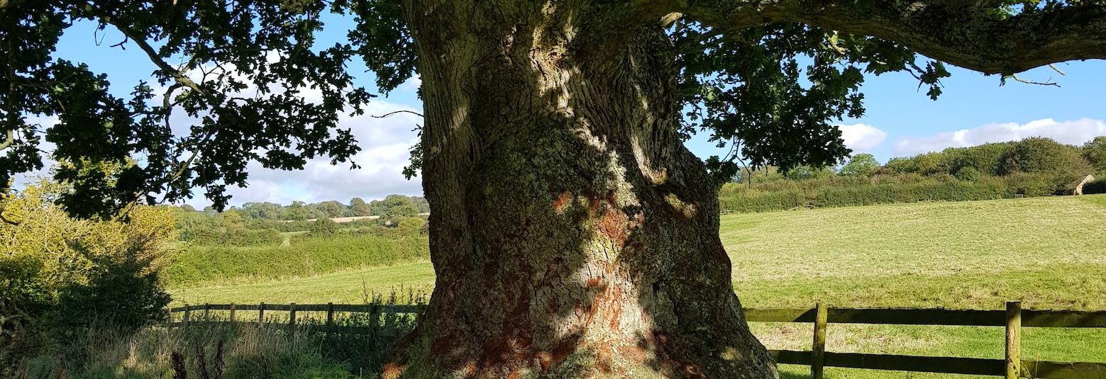
It's a simple formula. I take a train to a station, walk eight or so miles (sometimes more, sometimes less) to another station, which need not even be on the same line, then take the train home. Simple, rewarding. And as low carbon as possible. I am just another passenger on a service which would have run anyway. And on off-peak trains I’m not depriving someone of a seat, forcing them to reconsider using the rails and perhaps taking the car next time. (Photo - an oak tree on the walk from Moreton-in-Marsh to Kingham. By the writer.)
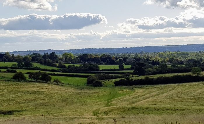
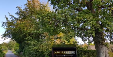
View towards Adlestrop: “Farther and farther, all the birds, Of Oxfordshire and Gloucestershire.” Edward Thomas – Adlestrop. (Photo: GHD)
Take the train to....?
Dent to Ribblehead, Leeds-Settle-Carlisle line.
I alight at Dent station, at 1,150ft the highest in England. Up here even the names are short, as if to save breath.
It’s from a lonely stop like this that I imagine Mary Lennox being driven in a carriage up into the moors to remote, mysterious Misselthwaite Manor in Frances Hodgson Burnett’s The Secret Garden.
“It’s just miles and miles and miles of wild land that nothing grows on but heather and gorse and broom, and nothing lives on but wild ponies and sheep.”
Dent is the summit of the Leeds-Settle-Carlisle line. It was the railway barons’ daftest, most heroic achievement, driven across desolate mires, aslant howling moors and speared through the sinew of the Pennines.
I’m walking to the next station but one, Ribblehead. It was the poor condition of the mighty 24-arch viaduct there that BR’s grey men in accounts took as the pretext to close this line in the 1980s.
Outrage gathered like snowdrifts on the flanks of nearby Pen-y-Ghent, and good sense prevailed. Funds were found for repairs, and the Settle-Carlisle was reborn as one of the UK’s most thrilling public transport experiences, as well as a lifeline to isolated communities.
Using my phone’s Ordnance Survey app, I plot a seven mile route, shadowing the railway. I pass under Great Knoutberry Hill and over Arten Gill Force (no such thing as a mere stream up here). Water the colour of Islay malt cascades off rock shelves. Wild Boar Fell glowers out of the mist. Sheep like wizened Yorkshire aldermen chomp the sparse grass.
I reach Blea Moor signal box, as remote from Clapham Junction as Ulan Bator, and walk down to the famous viaduct. Even today, trains pass gingerly over, as if out of respect for a national treasure. It is one of the few places in Britain where even non-trainspotters gaze in awe at a mere diesel loco.
At an immense height, a single plume of water hangs spookily from the stonework, coalescing into bloated, shuddering globules that burst around me. The only sound is the wind moaning under the arches.
I pick up the train at Ribblehead station. The Pennines conquered, we freewheel down the 14-mile ‘Long Haul’, back into the gentle landscape of the lower Dales.
Kemble to Swindon - the stripling Thames
Our greatest river begins under a protective spinney in a Gloucestershire field. Did Isambard Kingdom Brunel deliberately route his London to Cheltenham railway within yards of this spot, drawing support from the watery spirits? There’s a clue in the symmetry. My train to Kemble Station, a short stroll from the source, started at Paddington, which is only a mile from the Thames at its most regal.
The Thames Path runs billiard table-flat, and easy underfoot, to the estuary 184 miles distant. It is the most the most accessible of long distance trails. Today I’m walking the first 11 miles.
I follow the stripling river across a field under a line of tottering trees. There are still traces of once abundant haymeadows, through which Victorian writers would wade, kicking up clouds of seeds and perfume all the way to London. Then I find a real survivor. I picnic over the river on an ancient stone farm bridge garlanded with stonecrop, and watch aerial warfare between monster dragonflies on translucent wings.
It’s odd to walk along a boat-free Thames – the accepted starting point for navigation is Lechlade, 20 miles on – given over entirely to wildlife. A heron rises languidly, with the characteristic resistance to sudden departure of birds with big wings. Where there are herons, there must be fish. I muse on a vast community of water life exercising theoretical free passage all the way to the North Sea.
St. Sampson’s Church, Cricklade, appears, the four pinnacles on its tower like newly sharpened pencils crammed into a holder. Here the path cuts through one of Britain’s finest natural flowerbeds, enriched by millennia of flooding. In season North Meadow national nature reserve is a mile-long torrent of pink and purple snakes head fritillaries.
The young Thames will drift and dream for many more miles. But I leave it here. Still relying on public transport I take the 51 bus from Cricklade to Swindon station, (26 minutes 10 stops) for my train home.
Vale of Glamorgan Line
Vale of Glamorgan Line.
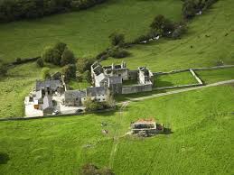
Old Beaupre Castle. Photo: Visit Wales
This is a low-carbon outing only possible with 21st-century transport investment. The Vale of Glamorgan Line, from Bridgend to Barry, threads through bucolic South Wales, the wide coastal buffer below the coal mining valleys. The line came, went, and has come again.
Read on…
http://www.directoryofdestinations.com/whistlestop-walk-vale-glamorgan-line/
Hastings to Rye
I feel the tug of the sea as I exit Hastings railway station. No need for a map. Just follow the wheeling seagulls downhill to the beach.
What does the town forever linked, with geographical imprecision, to England’s biggest home defeat do to erase 1000 years of hurt? It turns instant recognition to its advantage, rebranding itself and its pretty Sussex hinterland as “1066 Country”.
There is an attractive alternative “whistlestop walk” on the 1066 Country Walk six miles to the actual site of the showdown, on Senlac Hill, at Battle. But today I head east along part of the Saxon Shore Way, (12 miles, 19 km), to Rye, hilltop town of distinction.
I begin on the Hastings seafront, lined with handsome Georgian houses. At the eastern end is the historic fishing quarter, the Stade. This mazy skyscape of steep-roofed fishermen’s huts huddles under the cliff face, around Jerwood Gallery.
A line of fishing boats, one of Europe’s biggest fleet of beach-launched craft, is drawn up on the shingle. Local and small-scale, this traditional culture may represent the future of our seas. A good place to sample the sustainable haul is Webbes Rockanore, just back from the beach. They even tell you which boat caught your fish.
On this hectic, built-up Sussex coast, there is a glorious undeveloped gap in the smother of concrete to the east of Hastings, where my path steps up onto clay heights above pebbly coves and plunging valleys. In the spring a carpet of wildflowers rolls away north and a smudge of bright yellow gorse lights the cliff edge at Fire Hills. To the east is the lonely spread of the Pett Levels.
Beyond it is a coast ill at ease with the sea. My route follows a section of the C19th Royal Military Canal to Winchelsea, one of the, now inland, towns whose flourishing harbours were choked by ancient storms. In St Thomas’s Church I find the grave of Spike Milligan, illustrious Goon.
It’s a short step to the charming town of Rye, every medieval street a film set. I look down on the long golden expanse of Camber Sands. To the south, on a clear, slack day of low sun, the coast of France beckons dimly.
Moreton in Marsh to Kingham
The Great Western Railway website performs a useful calculation when I book my ticket for my Cotswolds day out. Making this trip by train I’m responsible for 58% less CO2 than if I’d gone by car. As we take the true environmental cost of travel seriously in the 2020s, expect to see much more of this extra detail.
I chose the Cotswolds because it’s a perfect destination for our carbon-conscious times, as we redefine what we understand by tourism. What counts as a satisfying leisure trip? Does a day out (ideally by public transport) among this region’s gorgeous golden stones leave you any less spiritually fulfilled than the energy-intensive long haul to Angkor Wat?
Google Maps plotted my itinerary. Two buses from my village to Oxford, then 34 minutes by train to Moreton-in-Marsh on the Paddington to Hereford railway conveniently running through the Cotswolds. Than I had six and a half hours to walk the nine miles back to the preceding station, Kingham, before taking the train home.
More…
Rainham Marshes
Rainham Marshes walk.
Murder comes with a sudden pounce, under a clear blue sky out in the marshes. The victim struggles, wriggles and flails, but its assailant has clearly killed before. All over in seconds. With one gulp the heron swallows the marsh frog whole. The nearby cows don’t even look up.
A reed bunting lightens the mood with a joyful “Nothing to see” aria, at about 100 notes a second.
This is no wilderness, deep in the countryside. I am on Rainham Marshes, one of the Royal Society for the Protection of Birds’ (RSPB) most unlikely reserves. Its setting could not be busier.
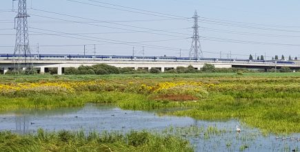
On one side, a sinuous Eurostar glides past to Paris. Behind me, the endless surge of M25 traffic crests the QE2 bridge. Swivelling west, I see Canary Wharf, nine miles away.
The reserve, where London folds into Essex, is the centerpiece of my easiest, and most accessible, Whistle Stop Walk to date. I start from Rainham station, two miles west. It’s five stops from Fenchurch St (22 minutes), within the London Travelcard zone.
Google Maps’ algorithms are not programmed for poetry. Its preferred route to Purfleet Station (four miles) is through dreary light industrial suburbia. I opt for the beautiful saunter along the north bank of the Thames (a mile longer).
The National Trust’s Rainham Hall, a “remarkably fine example of Queen Anne style architecture“, near the station, elegantly bookends this walk. I continue under the frantic A13, follow Ferry Lane, skirt an industrial park, and join a perfectly-paved path and cycleway, high above the river.
It’s a mile to the entrance of the RSPB reserve. I pay the £6 and take the two mile circular walk. It’s an irony that we have war to thank for the survival of this flat grazing land. In 1906 it became a military firing range. Many a doomed First World War infantryman learned to shoot here. The government kept it on its books, repelled developers and sold it to the RSPB.
The performance by 800 species (birds, beetles, amphibians, moths slugs and flowers) changes daily. No “star species” avocet or ringed plover today. But the stand-in wheatears, and a chorus of blackcaps, are just as glorious.
Then pure indulgence back at the visitor centre. Excellent coffee and scrumptious home-made cakes. There’s even a sticker saying who made them.
Pembrey and Burry Port to Kidwelly
Alighting at Pembrey and Burry Port Station I face the intriguing possibility of walking on for two months, keeping the sea on my left, then clinging to Offa’s Dyke down the Welsh border, before arriving back at this very spot.
Instead I will taste a modest, introductory 12 miles of the Wales Coast Path to Kidwelly, the next station. Circumnavigating an entire country will have to wait.
My first call is a plaque marking the end point of another epic journey. In 1928 Amelia Earhart landed here after a 20 hour flight from Newfoundland, the first woman to fly across the Atlantic. Much as I want to praise the early aviatrix, by her own admission she was “baggage, like a sack of potatoes.” She wasn’t qualified for that plane. Two male pilots took the controls.
I set off along the flat Carmarthenshire shore. The green, beating heart of this section is a fine example of habitat, legacy of the military-industrial complex.
Pembrey Dunes might have become a munitions testing range – it was previously the site of a royal ordnance factory. The sand hills were perfect for buffering accidental detonations. But the military was seen off in a 1971 public inquiry and it became one of Wales’s busiest country parks, bursting with wildlife.
The path enters its most bracing passage. Cefn Sidan Beach is eight miles long, and, it seems, almost as wide at low tide. Visitors are encouraged to do a two minute litter pick. All I can find in the time is three red string bags. A woman walking five dogs, quite against the bylaws, thanks me for being so public spirited
I stride on for two straight miles, in the teeth of a warm wind that sends plumes of sand scurrying towards me, towards an enduring landmark that has resisted the erosive capacity of the tide for almost a century. The SV Paul, a four-masted windjammer, beached here in a gale in 1925. Its surviving skeleton still stands above the sand, wearing imperceptibly away.
My fast march ends suddenly. The path veers 90 degrees inland and winds past an airfield linked to another famous flier. Wing Commander Guy Gibson, who led the Dambusters, trained here.
It’s a few flat miles to Kidwelly. Its military-industrial connections, too, are well past. The coal port has gone, and that immense expression of power politics, Kidwelly Castle, is the biggest tourist attraction for miles.
Phoenix Trail, Oxfordshire
From Princes Risborough (Bucks) via the Phoenix Trail. to Thame (Oxfordshire), Good connections to London (Marylebone), Oxford and Birmingham.
* * * *
I’m strolling in Deepest Britain, on a course originally set by a Victorian theodolite. Empty fields stretch silently away. A wren, an animated ball of feathers, tizzes urgently across my path to break the purest peace.
Far in the distance a dot gradually grows. Once it might have been the Oxford to London express, all fire and fury, trailing smoke over ancient hedges. But that is deep history. The dot becomes a lone commuter on a bike, taking the scenic route home on a safe, car-free, surface.
This is the Phoenix Trail, a seven mile path for walkers, cyclists, wheelchair users and horseriders between Princes Risborough and Thame. It is a long-lost Great Western Railway route through the Chilterns and across Buckinghamshire farmland, the HS2 of its day, but without the collateral damage.
Passenger numbers dwindled. Dainty tank engines replaced mighty locos. Then even the 1.47 to Tiddington and Littlemore drowsed off into the lyrics Flanders and Swann’s lament for lost railways, The Slow Train: “No churns, no porter, no cat on a seat, At Chorlton-cum-Hardy or Chester-le-Street”.
Most closed lines disappeared under neat housing estates and egg packing factories, or were sold to farmers and absorbed into the countryside. This is one of the few to survive, bought by Sustrans, the walking and cycling charity, and turned into one of the exclusive public ways in Britain.
It is flat and straight, but never dull. Original features are there to be read – ancient fence posts, the odd bit of crumbly platform in the undergrowth, stations and signal boxes turned into houses. And that incongruous line-side apple tree. Did it sprout from a core a schoolboy threw from a carriage window? We will never know. All part of a landscape where nature is back in charge.
I had taken the train to Princes Risborough to start the Phoenix Way. Reaching Thame (in Oxfordshire), I let Google Maps plot my route (2.6 miles, mainly off-road) to Haddenham and Thame Parkway station, where there are good connections to Marylebone, Oxford and Birmingham.
Bedford to Sandy
Bedford to Sandy
Bedford to Sandy is a poignant gap on our railway system. It was the central section of the Oxford to Cambridge Varsity Line, closed in 1968.
But this missing link is not just another opportunity for a sad, reflective wander in the countryside. The railway itself is being reinstated. It reopens around 2030 in an arc north of here. And conservation successes are dotted along it like bright buttons.
I leave Bedford railway station (on the St Pancras line; Bedford St Johns is the terminus for services from Bletchley) and head east to Priory Park, a spread of lakes, meadows, woodland and reed beds in a bend in the Great Ouse.
The former line has been transformed into that luxury countryside amenity, a joint footpath and cycleway (National Cycle routes 12 and 51 overlap). It starts here, running east for 7.5 miles (12 km), railway engineer-straight and tree-fringed through flat countryside, with the occasional wiggle to dodge privately-owned pieces.
Priory Park, created after gravel extraction ended in 1977, is only a hint of restoration riches to come, after a century of sand, gravel and brick clay digging that left this landscape shabby and pockmarked. My path leads through a much bigger habitat creation project, the Bedford River Valley Park. It will take shape over the next 20 years.
The Ouse, the biggest of the four by that name in England, is on my left. The Danish army tracked it inland when they attacked Bedford in 917. Today the river resounds to a peaceful beat. The Ouse Valley Way follows it 140 miles to the sea.
Cheddington to Leighton Buzzard
